About Services Tools Blog Contact us

Satellite Descent to a Site

Makes a square video that zooms down from a wide view to a target location at a steady pace, with an optional opening pan and a fading marker.

  • Terrain & Satellite
  • Cross-sector
  • Pipeline
  • Productised
  • Hybrid
  • 2026

The problem

A post about a remote site needs a map move that is easy to follow. Flying a globe capture by hand is slow, and it has to be done again for every new coordinate. A jump between two stills does not look like a descent.

What it does

You give the tool a target location, and it plans a zoom that changes scale at a steady rate, with an optional wide opening that pans to the target and holds. It saves the map images so repeats are quick. The output is a square video, a poster of the last frame, and a report of the ground width shown at each end. The marker and the corner credit can be turned off.

Outcomes

  • A site gets a descent video without a hand-flown capture.
  • The scale changes evenly, so the move is easy to follow.
  • A poster and a ground-width report come out with the video.
  • The next location needs only new coordinates.

Simplified mockup

Interactive preview with sample data. Nothing is sent to a server.

Descent

Flight 10.0 s

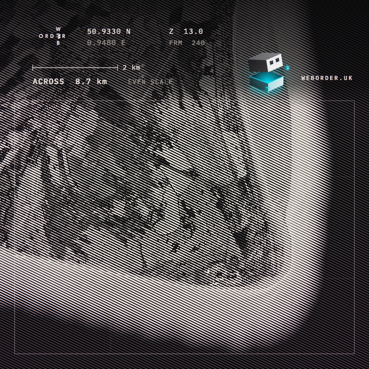
Dungeness · 50.9330, 0.9480

Rendered flight ready. Tiles were already cached.
  1. Wide view
  2. Even zoom
  3. Hold
  4. Poster

24 frames a second · 720 square · marker off · Cached regional imagery

Rendered flight

Widths 1,110 km across, down to 8.7 km across, in 10.0 s

Zoom runs from 6 to 13 and the scale change is even. The marker is off. The corner credit on this file is omitted; the line on the page is Cached regional imagery.

Ground width
ZoomAcrossRole
61,110 kmStart
138.7 kmEnd

Last frame

Last frame of the descent, the Dungeness headland about 8.7 km across
End width
8.7 km
Start width
1,110 km
Report

Dungeness, Kent

50.9330, 0.9480

240 square frames · marker off · credit omitted on the file. A repeat flight uses the cached tiles.

Output
Videoflyin.mp4 · 720 square · 10.0 s
Posterlast frame
Widths1,110 km to 8.7 km

How it works

  1. Set a target location, a zoom range and a duration.
  2. Space the zoom steps so the scale changes at an even rate all the way down.
  3. Fill the opening frames with an optional starting view, then pan to the target and hold.
  4. Save Esri World Imagery map images by zoom level, so a repeat flight does not download them again.
  5. Save the frames as a square video, with a poster of the last frame.
  6. Write a report of the ground width at the start and the end, and leave the marker out if wanted.

Pipeline

flowchart LR
  Target[Target coordinate] --> Plan[Even zoom plan]
  Start[Optional wide start] --> Plan
  Plan --> Tiles[Cached imagery tiles]
  Tiles --> Frames[Square frames]
  Frames --> Mp4[Square video]
  Frames --> Poster[Poster of the last frame]

Output

Sample output

Descent from a wide view to the Dungeness headland in Kent, marker off